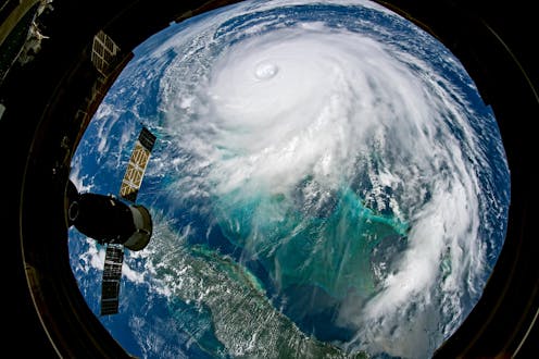
- Research shows that stalling has become more common for tropical cyclones in the North Atlantic since the mid-20th century and that their average forward speed has also slowed.
- Hurricanes are steered by the winds around them. We call this the atmospheric flow. If those winds are moving fast, they’ll move the storm fast. You can picture it as a leaf floating on a stream. If the stream moves slower, the leaf moves slower. When the flow turns, the leaf turns.
- A warmer atmosphere also means storms can tap into more moisture. As temperature increases, it’s easier for water to evaporate into vapor. In a hurricane, the opposite happens – water vapor reverts to liquid as cloud droplets, which means energy gets released, and that energy powers the storm.
- When a hurricane approaches land, there are multiple possible effects: the wind from the hurricane itself, the rainfall the hurricane produces and the storm surge that’s pushed by the hurricane.
- To forecast a storm, we look at what we call “dynamical guidance” – computer models that simulate the atmosphere and make a prediction based on our knowledge of physics. Forecasters put in variables such as the current wind, temperature and pressure, and the computer uses that starting point to simulate what the weather could be hours or days into the future. But our initial picture of the atmosphere is not perfect, and the computer can work only with what we give it. Each computer model is also a little different. They’re all based in the laws of physics, but the assumptions they make and how they take in data can vary from model to model.


https://youtu.be/-s7zOubwXmc
(Images/video taken from google/IE)

Leave a comment